


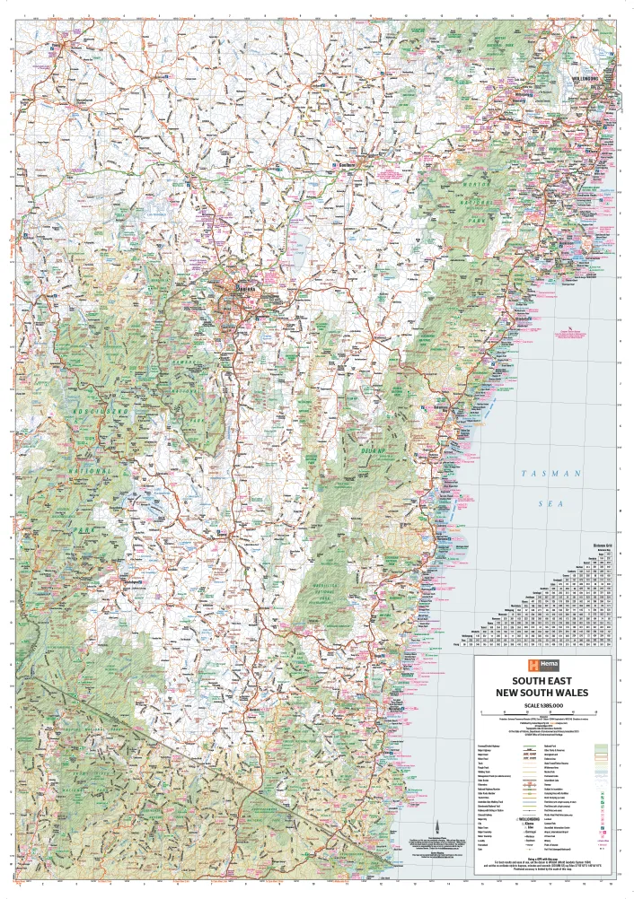
The South East New South Wales map by Hema is an excellent regional map that covers from Wollongong to the Victorian Border.
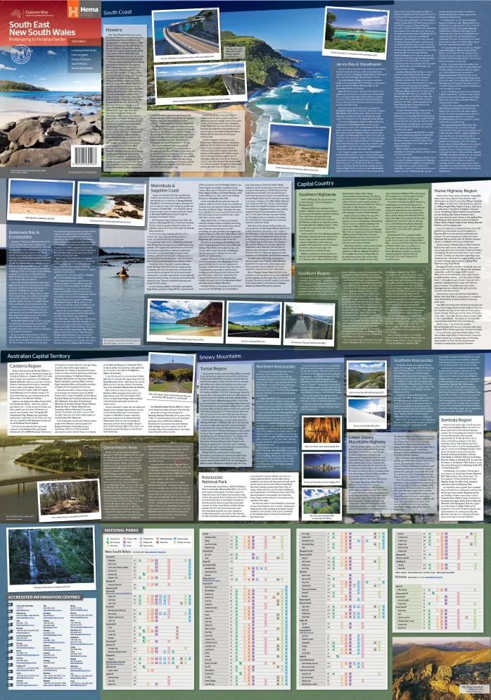
Extensive tourist information and photographs are provided on the area, every point of interest highlighted, and a table details all of the facilities available in the National Parks.
Also available in this series is .
- Camping areas
- National parks
- Wilderness areas
- Tourist information
- Points of interest
This map comes laminated allowing you to draw on it in whiteboard marker or apply to locations of interest without permanently marking the map. The lamination also makes the map very durable and protects against tears and stains.
To laminate this map we have taken the folded map and flattened it out before encapsulating it in high-quality 80-micron laminate, so please be aware that there will still be slight fold lines visible.
Scale: 1:375,000
Size: 700 mm (w) x 1000 mm (h)


